Fire Frequency Tool
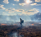
For use with ArcGIS - Prescribed fire is used widely to mitigate wildfires and restore ecosystems. This tool was developed to evaluate fire's cumulative impact, calculate frequency, examine seasonality and estimate fuel accumulation to facilitate decision making in targeting successive prescribed fire application.

Register your information here and you will be redirected to a page with a link to download the earlier version of the tool.

Register your information here and you will receive a link to download the FF Tool Zip file.
Authors: Jonathan M. Stober, District Biologist, Shoal Creek Ranger District, Talladega National Forest, Heflin, AL jstober@fs.fed.us
Geoff Holden, Forest Geospatial Program Manager, Francis Marion and Sumter National Forests, Columbia, SC. gholden@fs.fed.us
